


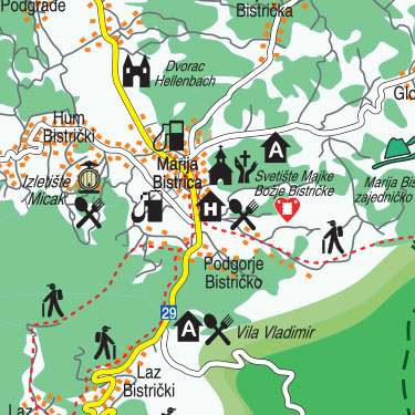
The Hrvatsko Zagorje tourist map can be used for printing (leaflet, brochure, paper maps), as a wall map or for the purposes of a pan. For each of these purposes, Hrvatsko Zagorje map is tailored to your needs.
Open format 98 x 45 cm
Closed format 13 x 22 cm
(source:en.wikipedia.org) Hrvatsko zagorje is a region north of Zagreb, Croatia. It comprises the whole area north of Mount Medvednica up to Slovenia in the north and west, and up to the regions of Međimurje and Podravina in the north and east. The population of Zagorje is not recorded as such, as it is administratively divided among Krapina-Zagorje County (total population 142,432), western and central part of Varaždin County (total population 183,730) and northwestern part of Zagreb County (total population 309,696). The population of Zagorje can be reasonably estimated to exceed 300,000 people.
Croatian people usually refer to this region as "Zagorje", a word which literally means "trans-mountain area", "beyond the mountain" (with respect to Medvednica). However, to avoid confusion with the nearby Municipality of Zagorje ob Savi in Slovenia, the Croatian part is called Hrvatsko zagorje, meaning "Croatian Zagorje".
The town of Krapina is often referred to as the cultural capital of Kajkavian dialect, the north-western dialect of the Croatian language. Every year, the Festival of Kajkavian Song (Festival kajkavske popevke) takes place in Krapina.